|
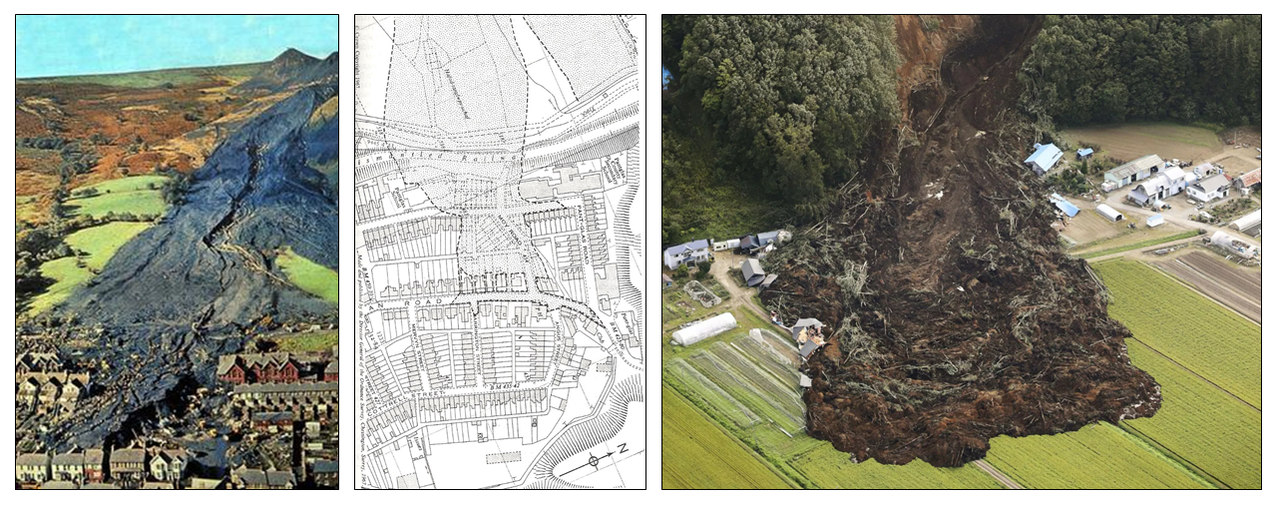
At CCH we reinvest into industrially relevant research and development. We think we are closing in on a product/modelling technique that is potentially beneficial to yourselves and your clients. We can see a broad range of applications for this throughout the water, mining and asset management areas of your business. We’ve recently had some success with modelling granular and debris flow using non-newtonian modelling techniques. With our background in dam break modelling and consequence modelling for portfolio risk assessment, we believe that this could form part of a powerful assessment to help your clients manage their capital expenditure programmes for mining and water assets, for example. For example, if a mining company owns a number of spoil heaps above urbanised or populated areas, then at present it is unlikely that the true consequences of failure of each of these assets is well understood. We’ve been using real world events such as the Aberfan disaster and the recent Hokkaido landslides to calibrate our non-newtonian fluid solver model for granular and debris flows. This could be used to determine the consequences of failure for specified failure surfaces (or a range of surfaces) using fragility assessment techniques. This would represent a cutting edge risk classification product, and in combination with a detailed ground stability model will allow us to build a portfolio risk assessment for clients. This can then be used to justify engineering and risk mitigation works where it is proportionate, and to prioritise the order that these works are undertaken. The only way that this can be done is to have both a detailed knowledge of the probability of failure (developed by using 2D and 3D ground stability models with Monte Carlo methods to estimate uncertainty, or some simple rules like failure depth or slope angle) and a detailed knowledge of the consequences of failure (which could be generated by our non-newtonian catastrophe models). This could apply to a number of different types of assets with different receptors:
Please see the following videos of the technology in action (developed during our research). We can work with you to make sure that the project gives a good representation of the particular features that your geotechnical engineers or clients are concerned about. We can build in Monte Carlo assessment methods and use published values to determine a range of probable ‘inundation’ zones based on any given failure surface. Videos
We hope that you find this development useful, and we would be delighted to discuss this with you further to see how we can produce a combined and collaborative approach that helps your own, or clients with an asset risk portfolios and capital expenditure programmes.
|
Archives
November 2018
Categories |
Services |
Company |
|


 RSS Feed