
Hydropower
The hydropower industry exists on a number of different scales. In the UK it is common to look at small hydropower schemes (<2MW), potentially only Run of River and without a reservoir. Elsewhere in the world hydropower schemes tend to be larger and are a key development resource. Proof of scheme economics is key in successful project delivery for both types of developments. We can help with a number of aspects of the Pre-Feasibility and Feasibility level design for both large and small schemes, including initial screening assessments to find viable sites in very large regions of countries all over the world.
typical studies
|
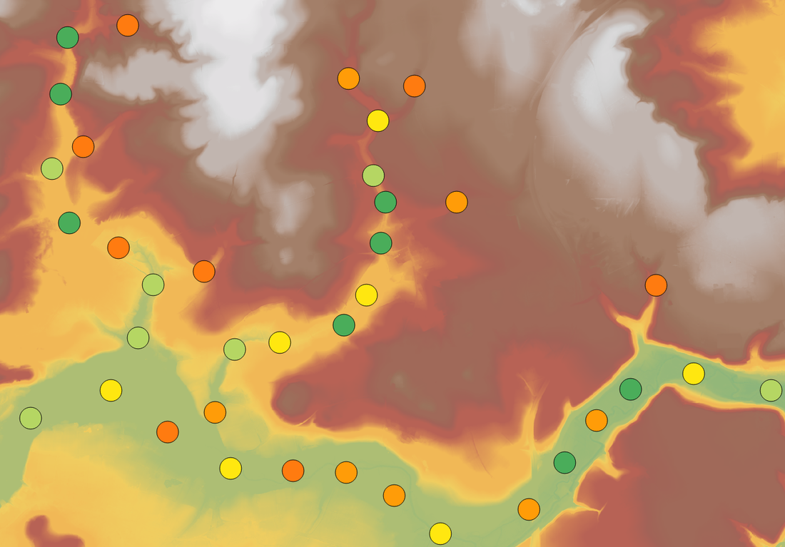
Hydromapping and Screening Assessments
Developers who are looking at large portfolios of land or are targeting regions (or even entire countries) will first need to understand where the sites of greatest potential are. We can provide bespoke hydromaps, and even undertake a spatial Multiple Account Analysis to rank the best sites based on other non-water based variables such as distance from roads, transmission networks and any significant areas of population and environmental designations. This isn't just for conventional hydropower either, we can produce similar maps for pumped storage schemes. |
|
Energy Yield Studies for Run of River Schemes
Run of River (RoR) schemes are those where storage is negligible. This is a commonly adopted strategy in the small hydropower market where asset owners do not want to take on the responsibility of owning a reservoir/dam. We can help determine the potential energy capture of RoR schemes and help owners consider multi-turbine arrangements and turbine types based on the flow statistics of sites. In the UK we can provide pre-feasibility level assessments without the need for river gauging. |
Energy Yield Studies for Reservoir Schemes
Whilst reservoir based schemes tend not to be operated in part flow conditions in the same way as RoR schemes, the storage of the proposed asset and potential operational rules make calculating energy yield more complex. We can help by using detailed topographic surveys to determine storage relationships and assist with the production of basic operational rules to make best use of the reservoir. We can do this both for green field sites and reservoirs which are being repurposed. |
|
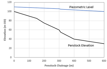
Hydropower Scheme Hydraulics
Once a scheme has been decided upon, we can reduce the uncertainties in your energy yield studies by undertaking a detailed hydraulics assessment of the penstock arrangements. This ensures a good knowledge of the pressures expected at the power house and turbines, and is required for the selection and design of turbines. |
|

|
Hydrological Yield Modelling
It is sometimes hard, particularly in developing countries, to get lenders on board for large hydropower schemes when there is limited hydrological information. We can produce detailed spatially distributed hydrological models which are informed by satellite precipitation data (NASA's TRMM and GPM datasets), satellite potential evapotranspiration data (NASA's MODIS mission), global landuses (ESA's GlobCover Archive) and soils information (ISRIC's soil grids). We can undertake conceptually lumped models if acceptable, but for large catchments we would instead undertake a spatially distributed model with SWAT or HEC HMS. We can calibrate to a bespoke river gauge or produce donor coefficients from neighbouring catchments. |